D-LIO is a 6DoF Direct LiDAR-Inertial Odometry approach that
simultaneously maps L1 truncated distance fields (Fast-TDF) on CPU. This
continuous representation lets it work directly with raw 3D LiDAR data online — without LiDAR
feature selection or tracking — casting point-cloud registration as a nonlinear optimization
while updating the map at constant time, independently of its size. Benchmarked
against state-of-the-art odometry methods, D-LIO matches or exceeds their accuracy.
Method
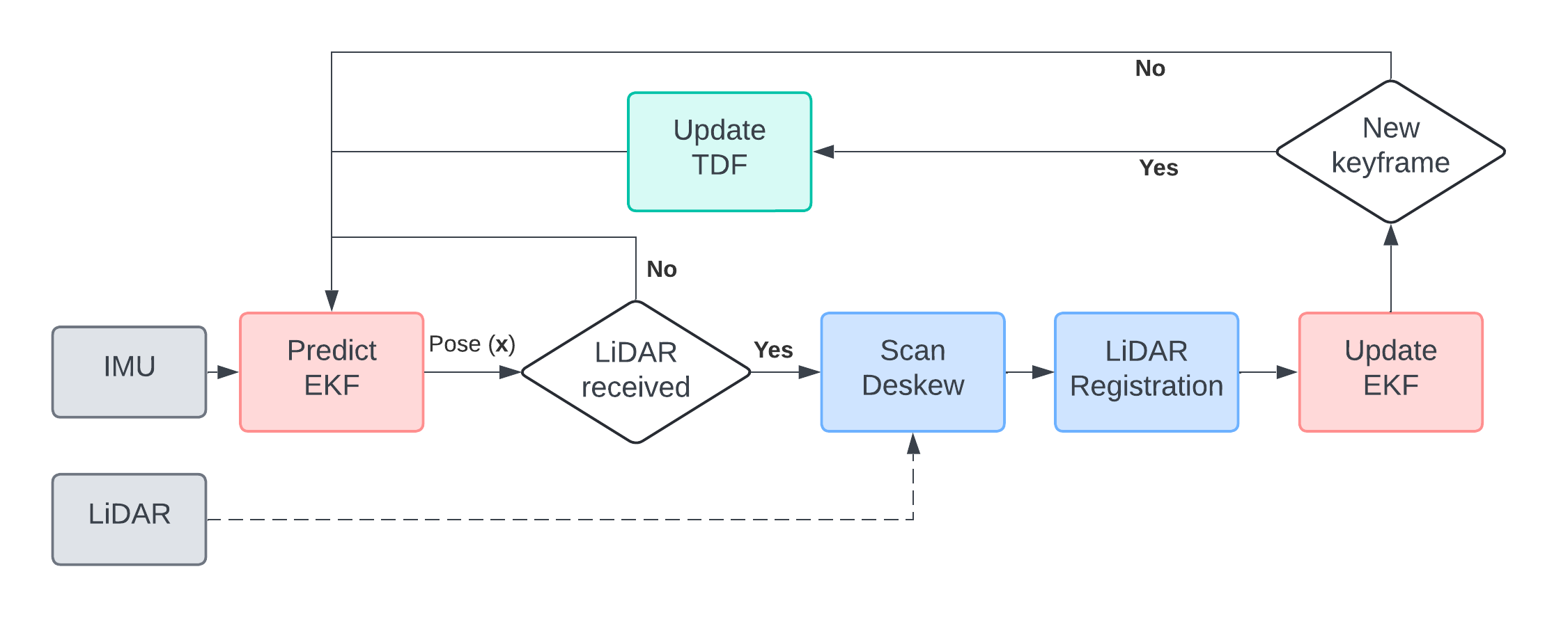
EKF-based Pose Estimation & TDF Mapping
The D-LIO algorithm incrementally estimates the system pose using an
Extended Kalman Filter (EKF). It integrates inertial measurements for
pose prediction and uses point cloud-to-map registration for pose updates.
The environment is mapped based on the Truncated Distance Field (TDF).
This alignment is used to constrain the EKF's pose and velocity.
Whenever the estimated pose variation exceeds a threshold, the TDF map is
updated by incorporating new information.
Fast-TDF
The core of D-LIO is the Fast Truncated Distance Field (Fast-TDF). This
method represents the environment as a 3D grid, but instead of just storing "occupied" or
"free", it efficiently encodes the L1 distance to the nearest obstacle.
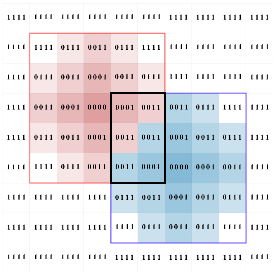
To achieve constant-time map updates, it uses a pre-calculated binary kernel.
The distance in this kernel is represented as a bit-set mask, where each set bit accounts
for the distance.
This encoding has a key advantage: the shortest distance from multiple overlapping kernels can
be found with a single, highly efficient bitwise-AND operation. This avoids
complex comparisons and makes the process parallelizable on the CPU.
Binary Mask (4-bit)
L1 Distance
0000
0 (Center)
0001
1
0011
2
0111
3
1111
4 (Max / Truncation)
Table 1 — Correspondence between bit-set masks and L1 distance.
Figure 1 — The final distance map (center) is computed by applying the bitwise-AND operation to
overlapping kernels (top/bottom).
Results
We benchmarked D-LIO on three challenging public datasets: VIRAL,
Newer College, and VBR. These tests evaluate performance in diverse
scenarios, including aerial (UAV) and ground platforms, against several state-of-the-art (SOTA) methods.
Trajectory Accuracy (ATE)
The Absolute Translation Error (ATE) [m] was measured on the VIRAL and Newer College
datasets. As shown in the table, D-LIO achieves consistently high accuracy, ranking first or
second in most sequences. It remains highly competitive even when compared to methods that
utilize back-end optimization (like LIO-SAM or PIN-SLAM), which D-LIO does not.
Sequence
D-LIO
A-LOAM
M-LOAM
KISS-ICP
FAST-LIO2
LIO-SAM
PIN-SLAM
eee01
0.074
0.212
0.249
2.383
0.166
0.075
-
eee02
0.073
0.199
0.168
1.586
0.100
0.069
2.056
eee03
0.121
0.148
0.233
1.055
0.142
0.101
0.615
nya01
0.080
0.077
0.123
0.359
0.127
0.076
0.086
nya02
0.104
0.091
0.191
-
0.151
0.070
0.092
nya03
0.065
0.108
0.226
1.389
0.130
0.137
0.455
sbs01
0.085
0.103
0.173
1.353
0.130
0.089
0.205
sbs02
0.067
0.091
0.147
1.435
0.144
0.083
0.528
sbs03
0.098
0.367
0.153
1.037
0.126
0.140
0.708
q-easy
0.093
0.085
0.141
0.100
0.100
0.074
0.090
Table 2 — ATE (m) on VIRAL and Newer College. Best (bold) and second-best
(underline) odometry methods.
Scalability on Large Datasets
To evaluate performance in large-scale environments, we used the VBR dataset,
featuring long trajectories (up to 2.5 km) in complex indoor/outdoor settings. D-LIO demonstrates
robust scalability, maintaining low ATE (m) and Relative Pose Error (RPE) (%).
Sequence
D-LIO
KISS-ICP
PIN-SLAM
diag
0.560(0.72%)
1.397 (1.79%)
0.362(0.47%)
pincio
7.390 (3.45%)
0.784(0.49%)
0.647(0.45%)
Table 3 — ATE (m) and RPE (%) on the VBR dataset.
Mapping Quality
We also evaluated the 3D reconstruction quality on the Newer College (Quad-Easy)
sequence using standard metrics: Accuracy, Completeness, Chamfer-L1 (C-L1), and F-Score. D-LIO
produces highly competitive maps, achieving the best completeness and ranking second
for C-L1 and F-Score among all tested odometry-driven methods.
Method
Pose
Acc. (cm)
Comp. (cm)
C-L1 (cm)
F-Score (%)
VDB-Fusion
KissICP
14.03
25.46
19.75
69.50
SHINE
KissICP
14.87
20.02
17.45
68.85
NKSR
KissICP
15.67
36.87
26.67
58.57
PUMA
Odometry
15.30
71.91
43.60
57.27
SLAMesh
Odometry
19.21
48.83
34.02
45.24
NeRF-LOAM
Odometry
12.89
22.21
17.55
74.37
S²KAN-SLAM
Odometry
13.32
18.80
16.06
72.03
ImMesh
Odometry
15.05
19.80
17.42
66.87
PIN-SLAM
Odometry
11.55
15.25
13.40
82.08
KN-LIO
Odometry
8.18
11.65
9.92
91.01
D-LIO
Odometry
12.14
10.63
11.39
83.83
Table 4 — Mapping metrics on Newer College. Best (bold) and second-best
(underline) scores.
Runtime Analysis
The system's performance was analyzed on an Intel Core i7-13700H CPU without GPU
acceleration. The map update step is the most computationally expensive, as its time
strongly depends on point cloud density. However, optimization runs at the sensor rate (10 Hz)
while updates are triggered less frequently, balancing the load.
Dataset
Points (avg.)
Total (s)
Optimize (s)
Update (s)
eee
~20k
0.048 ± 0.055
0.046 ± 0.013
0.155 ± 0.009
nya
~20k
0.049 ± 0.034
0.042 ± 0.014
0.146 ± 0.016
sbs
~20k
0.051 ± 0.048
0.044 ± 0.016
0.142 ± 0.034
q-easy
~100k
0.479 ± 0.196
0.442 ± 0.158
0.470 ± 0.095
diag
~190k
0.603 ± 0.240
0.565 ± 0.194
0.315 ± 0.085
pincio
~140k
0.576 ± 0.256
0.505 ± 0.182
0.563 ± 0.146
Table 5 — Runtime analysis (mean ± std. dev) with no downsampling.
Project Video
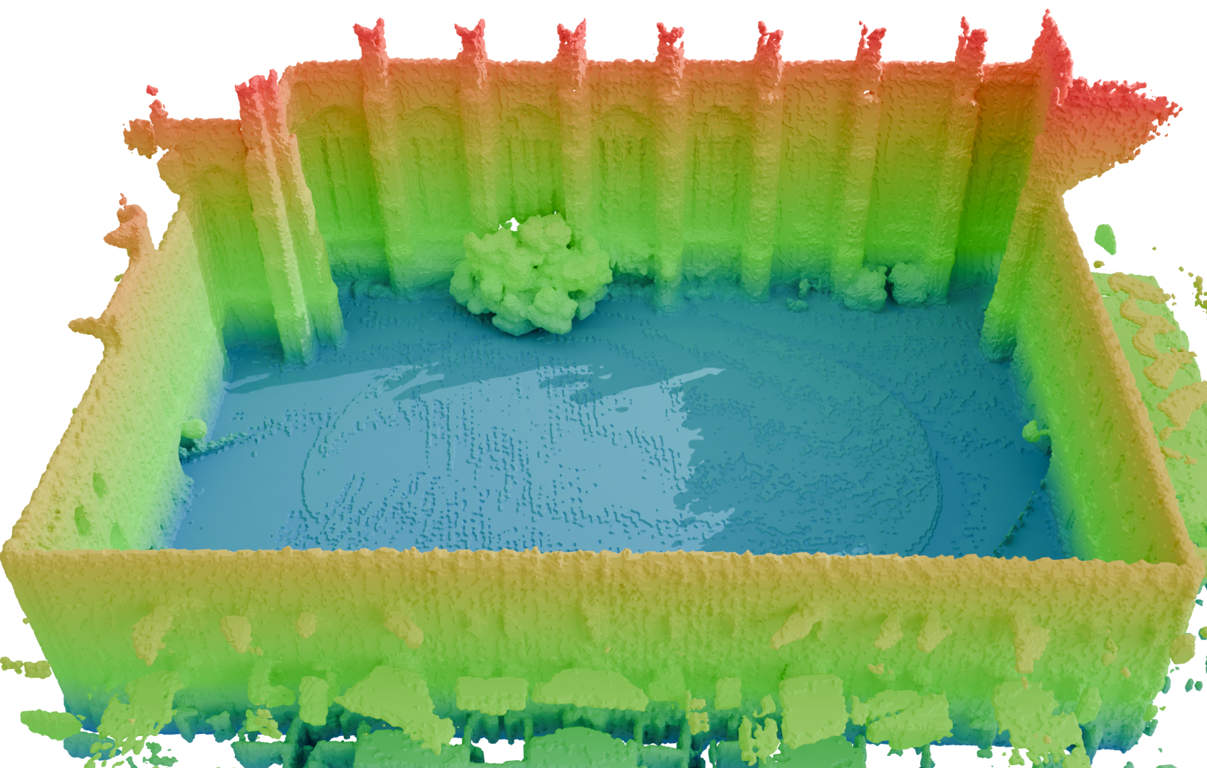
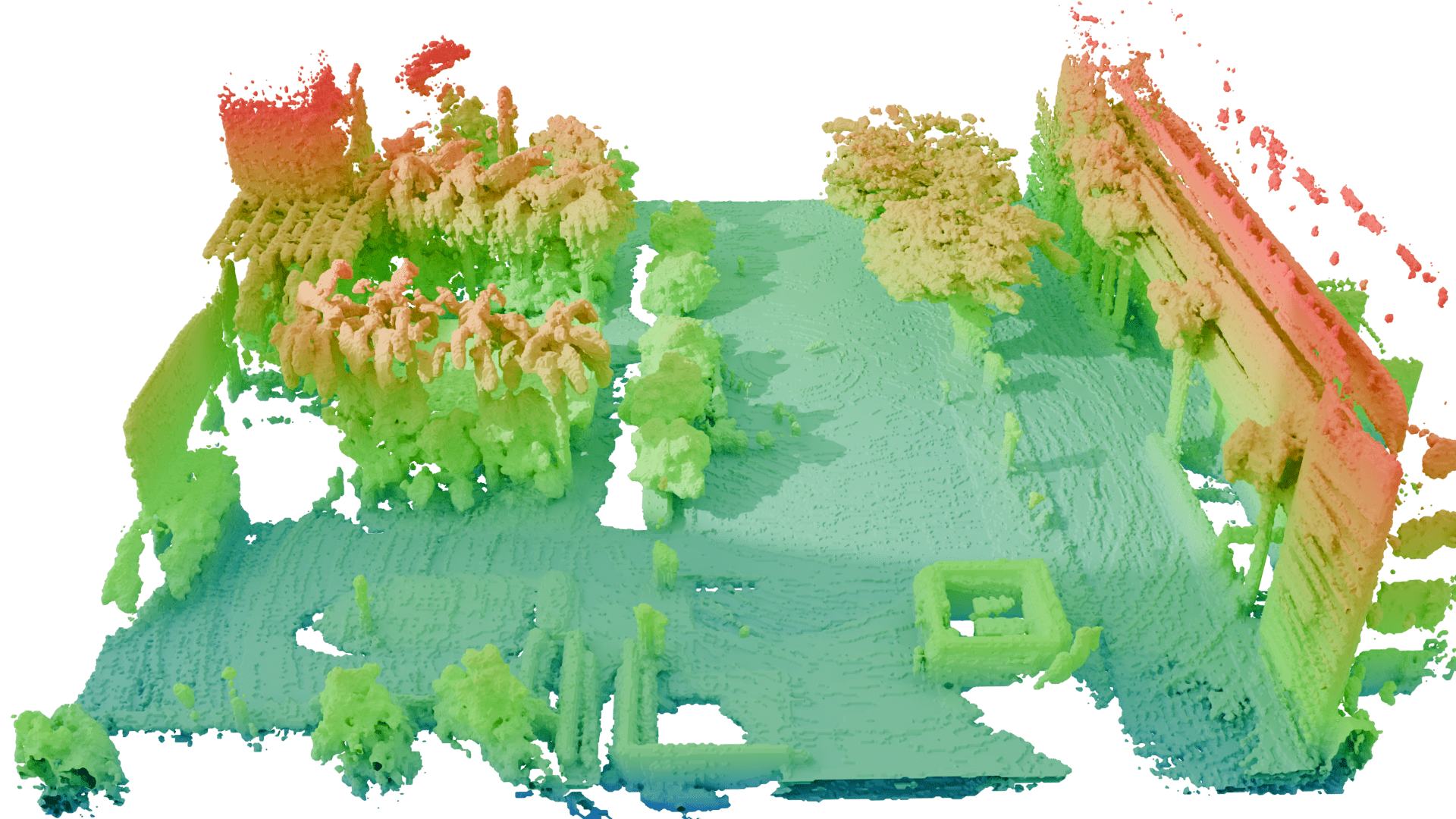
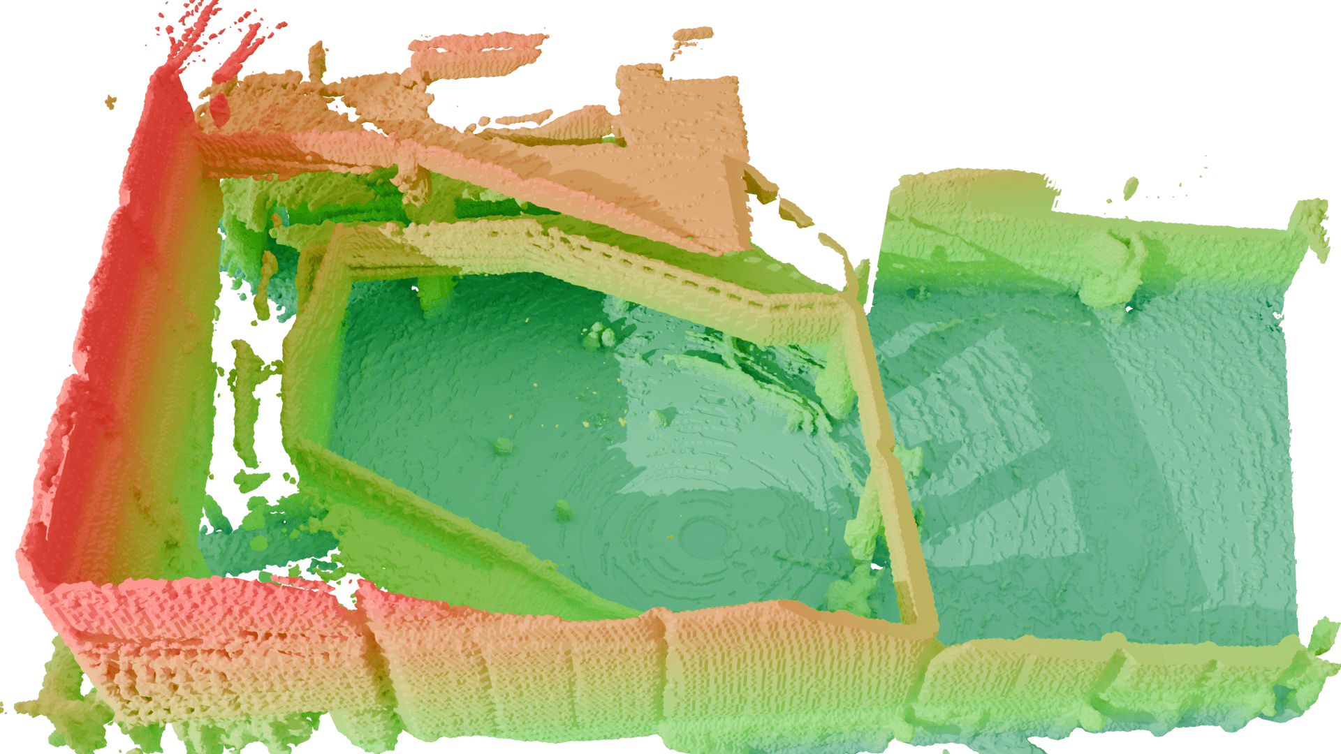
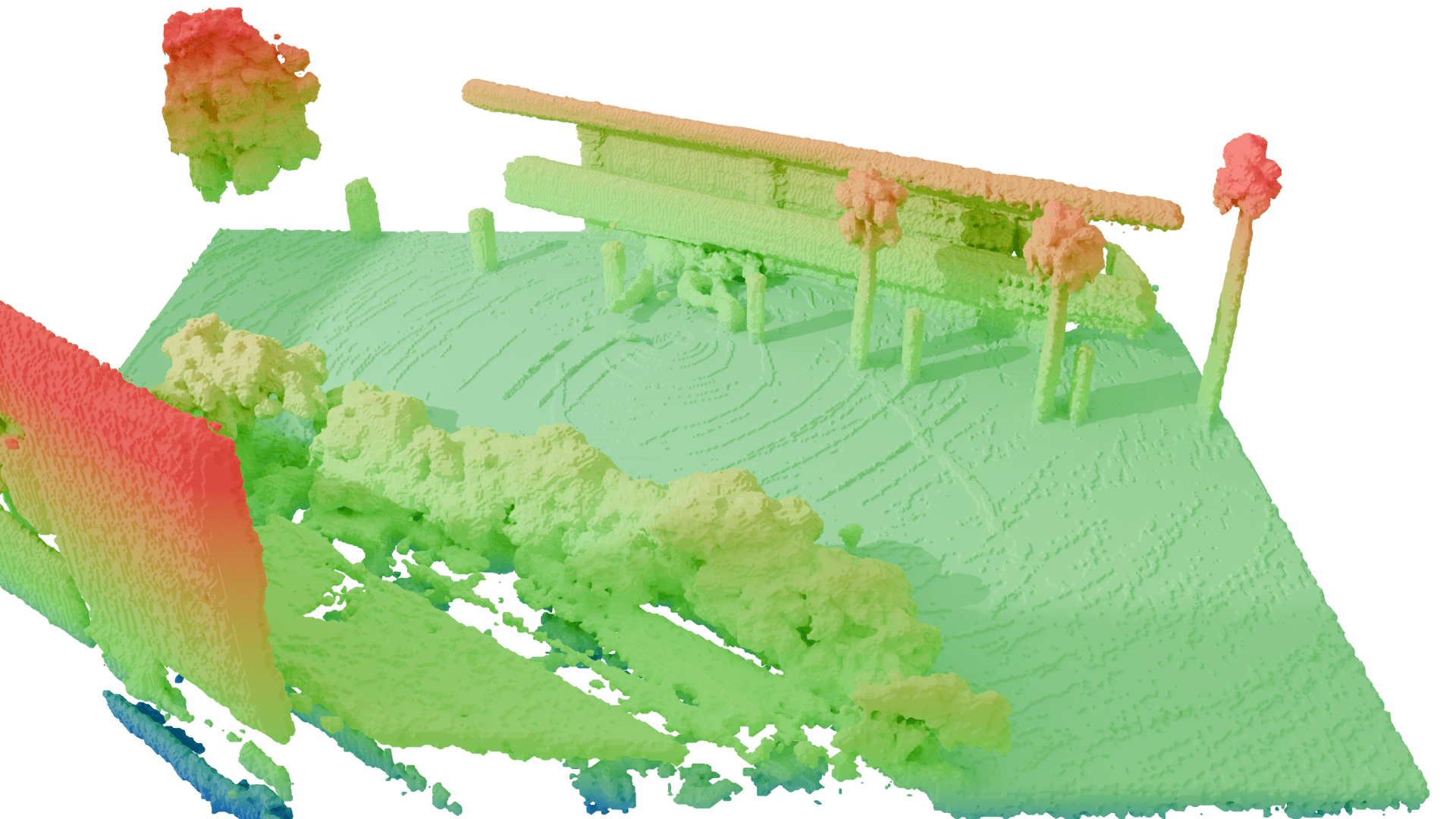
Qualitative results, 3D reconstructions, and estimated trajectories from the datasets.
Citation
If you use D-LIO in your research, please cite our paper:
BibTeX
@ARTICLE{11248856,
  author={Coto-Elena, L. and Maese, J.E. and Merino, L. and Caballero, F.},
  journal={IEEE Robotics and Automation Letters},
  title={D-LIO: 6DoF Direct LiDAR-Inertial Odometry Based on Simultaneous Truncated Distance Field Mapping},
  year={2026},
  volume={11},
  number={1},
  pages={169-176},
  keywords={Odometry;Laser radar;Point cloud compression;Accuracy;Feature extraction;Location awareness;Kernel;Simultaneous localization and mapping;Real-time systems;Three-dimensional displays;Mapping;odometry;simultaneous localization and mapping},
  doi={10.1109/LRA.2025.3632615}}